The idea that the ocean has been managing its own transportation system for millions of years and we have only recently become aware of it is somewhat humble. Nothing that could be seen from a boat or a satellite image, not even a road or a channel. The world’s largest fish, whale sharks, seem to have known about this system of deep-ocean currents, seamounts, underwater canyons, and invisible thermal corridors all along.
A ten-year satellite tracking study that was published in Frontiers in Marine Science has quantified what marine biologists had long suspected but were unable to confirm. Between 2015 and 2025, researchers tagged and observed seventy whale sharks at four Indonesian aggregation sites: the Gulf of Tomini in Sulawesi, Kaimana near Triton Bay, Saleh Bay in Sumbawa, and Cenderawasih Bay in West Papua. Over 990 days were spent on some tags. Over 400 was the average. That data produced more than just a map. It is more akin to a revelation.
The sharks were moving on. They were traveling through 13 nations and territories, including Australia, Papua New Guinea, the Philippines, Palau, Micronesia, and several Pacific island regions, on purpose, seasonally, and across enormous expanses of open ocean. They were navigating into international high seas, regions that are outside the legal boundaries of any one country, using cues that scientists are still trying to fully comprehend, such as the availability of food, the temperature of the water, and deep-ocean currents that leave no trace on the surface. You might be floating right over one of these migration corridors without realizing it.
In a Conservation International release, lead author Mochamad Iqbal Herwata Putra, senior manager of focal species conservation at Konservasi Indonesia, put it this way: the research completely changes the management perspective from isolated aggregation sites to something far more interconnected—a pelagic system that doesn’t respect borders, tourism seasons, or protected area boundaries. That is a significant conceptual change. The way whale shark conservation must operate has to be fundamentally rethought.
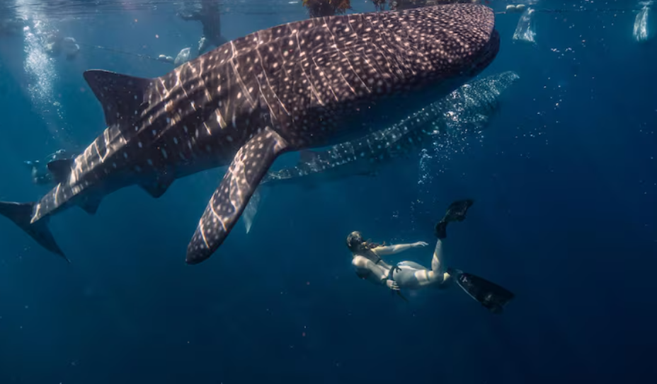
The fact that locations like Saleh Bay and Cenderawasih Bay were already regarded as significant makes this especially startling. Divers come to these locations from all over the world. They are well-known. However, the study discovered that the events in those bays are only one part of a much longer narrative. These large bay systems may serve as nursery habitats for younger, juvenile sharks because whale sharks have been observed using them year-round, which is unusual for a species usually associated with seasonal visits. It’s possible that the sharks photographed in Cenderawasih Bay against sunlight shafts are the same creatures that later navigate open-ocean eddies thousands of kilometers away, in waters where neither dive operators nor rangers are present.
Whale sharks have ancient ocean pathways, according to Dr. Edy Setyawan of the Elasmobranch Institute Indonesia, who summed up the situation. It’s a powerful framing. The study did not create these routes. They have been around for a lot longer than any marine protected area boundary or international maritime law. The research simply caught up to something that was already underway.
According to the data, more than 40% of the habitat of adult male whale sharks is found in high seas areas, such as feeding zones and migration corridors connected to seamounts and underwater canyons, where there is, at best, little legal framework for protection. The actual exposure occurs there. Not in the bays where dive boats congregate and visitors adhere to regulations, but in the vast ocean between countries, where cargo ships and fishing boats operate largely unchecked in comparison to the scope of the threat.
It’s difficult to look at this study and not feel a certain sense of urgency—not fear, but the particular unease of realizing that we’ve been shielding something’s periphery while leaving its core vulnerable. The sharks are contributing by traveling along historic routes and traversing boundaries that are only depicted on maps created by humans. To be honest, it’s still unclear if the global conservation community can keep up with them.