

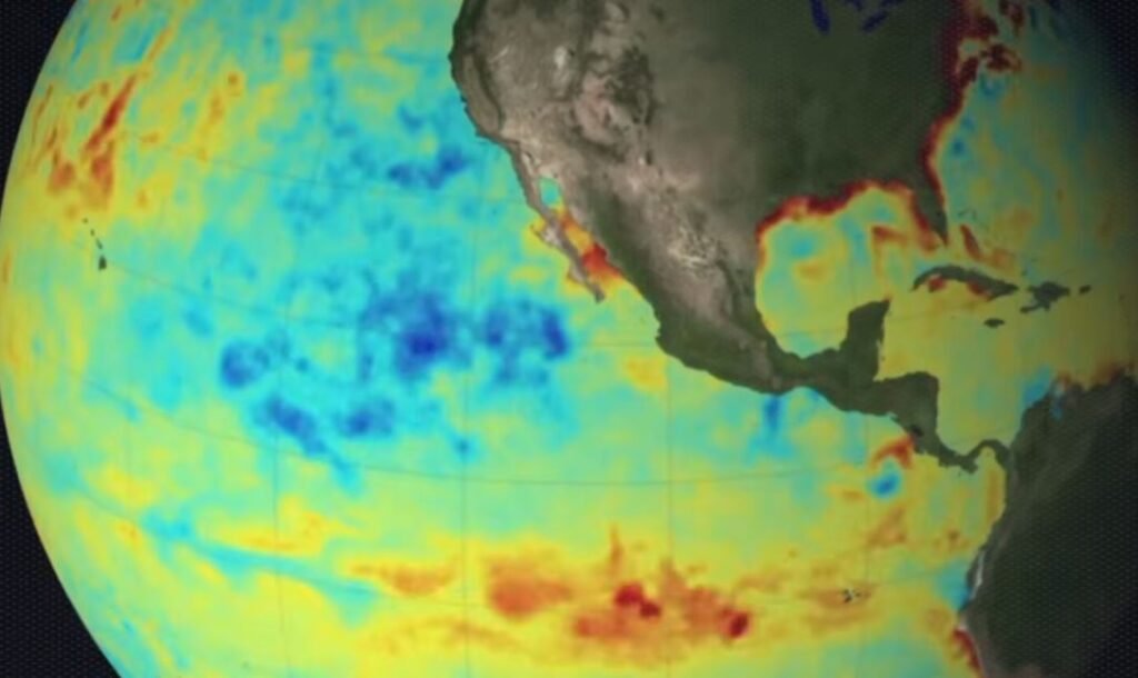
For months, signals have been coming from the Pacific Ocean. weakening trade winds, warmer-than-normal water accumulation close to the equator, and a gradual disintegration of the atmospheric patterns that typically maintain stability. El Niño officially formed in the tropical Pacific on June 11, according to NOAA’s National Weather Service, and forecasters think it’s just getting started.
This is not your typical seasonal forecast. According to the Climate Prediction Center, there is a 63% chance that sea surface temperatures in the monitored equatorial zone will rise above 2°C, which would put this event in “very strong” territory. Although forecasters are usually cautious when using that term, some have already referred to it as a possible Super El Niño. According to climate scientist Daniel Swain, the trajectory of this El Niño hasn’t flattened and is tracking as strong or stronger than anything previously recorded for the calendar date.
Fundamentally, El Niño is a disturbance of the Walker Circulation, which is a huge east-to-west air movement caused by temperature variations throughout the Pacific. Warm water moves eastward toward South America when that circulation weakens, and the consequences spread far beyond the tropics. When equatorial Pacific temperatures are at least 0.5°C above average for several months in a row, NOAA formally declares El Niño. At the moment, those temperatures are significantly higher than those found along portions of the South American coast.
The practical translation arrives in the winter for the majority of the United States. Strong El Niños typically push the jet stream southward, bringing storm systems across the country’s southern tier and leaving the northern Rockies and portions of the Ohio Valley drier than normal. It gets wetter in the South. The climate in the Pacific Northwest is typically drier and warmer.
High tide flooding, which NOAA has identified as a potential compounding issue when El Niño-driven sea level changes combine with current tidal patterns, is an additional risk for coastal communities along the West Coast this year. In line with what a strengthening event typically produces, NOAA’s own forecasts for South Carolina this fall already indicate above-normal temperatures and above-normal precipitation.
The narrative is a little more nuanced in North and Central Texas. According to forecasters, there is a 70–90% chance of above-average precipitation in the spring of next year, followed by drier conditions throughout the summer. Strong El Niño years have historically shown a tendency toward lower-than-average winter temperatures, especially in the second half of the season. Nevertheless, other oscillations in the global circulation tend to greatly obscure the signal.
Additionally, NOAA is now tracking all of this in a more subtle but significant way. The agency replaced the previous static index, which measured ocean temperatures against a fixed 30-year baseline, with the Relative Oceanic Niño Index, or RONI, in February.
The new system is more sensitive to shifts that might otherwise go unnoticed because it updates on a monthly basis. NOAA scientists concluded that the RONI more accurately tracked the atmospheric changes that truly characterize El Niño behavior after five years of parallel monitoring. It’s a technical adjustment, but the kind that counts when the event being measured might be approaching previously unheard-of levels.
It is more difficult to comprehend the economic aspect. A very strong event similar to 1997–1998 could result in approximately $686 billion in short-term losses globally, with cumulative five-year losses potentially reaching $3 trillion once the ripple effects on investment are taken into account, according to researchers at the Peterson Institute for International Economics, based on earlier work modeling El Niño’s effects on global growth. Lower-income tropical countries bear a disproportionate share of the burden; in these countries, poor harvests and damaged infrastructure lead to years of slower growth. Seldom does that portion of the story appear on the evening news.
In its methodical institutional manner, the National Weather Service is conveying the fact that the window for preparation is real and closing. The monitoring tools are at an all-time high. Over the previous 20 years, the predictions have greatly improved. History is not particularly promising in that regard.
