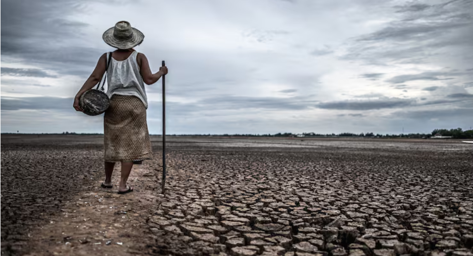
The bone-dry reservoirs of Arizona, the wilting cotton fields of the Southern Plains, and the cracked earth of West Texas all told a story that climate forecasters were unable to fully understand for decades. The figures from the Pacific Ocean appeared to be accurate. The forecasts made sense. Season after season, however, the predictions fell short of the actual suffering.
It turns out that there was a quantifiable explanation for that gap. In recent years, NOAA’s conventional approach to tracking El Niño and La Niña has experienced notable misses, and researchers have finally determined a major cause. Sea surface temperatures in the east-central tropical Pacific were measured by the former Oceanic Niño Index, or ONI, against a long-term average, which was progressively rising as the world’s oceans warmed. A slow distortion was the outcome. For farmers and water managers in the American South, recent El Niños appeared stronger than they actually were, and La Niñas, the dry-season driver, seemed weaker than they actually felt. Climate Connections at Yale
To better describe the past, present, and future of the El Niño-Southern Oscillation, or ENSO as scientists refer to it, NOAA’s Climate Prediction Center adopted a new metric in February 2026 called the Relative Oceanic Niño Index, or RONI. In contrast to the conventional ONI, RONI takes into consideration long-term trends in ocean temperature, offering what NOAA refers to as a more accurate depiction of seasonal climate variability. The change has a technical, almost bureaucratic sound. However, it has far-reaching consequences for drought forecasting in the southern United States. Drought.gov Take a look at what the previous index overlooked.
The winters of 2020 through 2023 were categorized as a “triple-dip” La Niña—three distinct events—using the conventional ONI. That period is reclassified by RONI as a single, continuous, three-year La Niña. In the Southwest and Southern Plains, those years were harsh. Aquifers began to decline. Herds of cattle were killed early. In areas where it had never dried up before, the Rio Grande shrank to a trickle. The people who lived there weren’t surprised by the drought, but the forecasting systems might have underestimated it. Drought.gov
More recently, the same misinterpretation occurred. According to the conventional ONI, the 2023–24 El Niño was predicted to bring significant precipitation to the southern United States; however, the rainfall patterns and atmospheric response were not as strong as anticipated. In fact, the RONI was more in line with the subsequent weather patterns and displayed a weakened El Niño signal. The difference between ranchers planting pastures that burn out before summer arrives or water managers releasing reservoir storage in anticipation of rain that never arrives is subtle but has significant ramifications. Drought.gov
RONI is less sensitive to the 30-year reference period being used, which means that past events are classified more consistently as conditions change over time. It also better reflects when ENSO-related atmospheric patterns are actually present, improving the alignment with seasonal forecasts. This type of stability is crucial for drought forecasters, who rely on ENSO to determine confidence levels for seasonal outlooks.
They can inform a municipal water authority or a county extension agent not only that drought is possible but also how likely and severe it is with a stronger, more dependable signal. Looking ahead, the arid southern tier has cautious cause for optimism, according to the NOAA Climate Prediction Center. According to the most recent NOAA Climate Prediction Center assessments, there is an 82% chance that El Niño will form by the May-July 2026 window.
The equatorial Pacific’s subsurface ocean temperatures have been higher than usual, and the trade winds have begun to weaken, both of which are typical precursors. The rainfall that large areas of Texas, Oklahoma, and the Southeast have been waiting years for may finally arrive as a result of this change. However, there is no assurance that even a developing El Niño will put an end to drought conditions without historically wet conditions that could cause their own issues, such as flooding.
Drought.gov, the NOAA Climate Prediction Center Better results are not guaranteed by what RONI offers. The compass is more accurately calibrated. In a world where the baseline is unstable and the ocean you’re comparing today’s temperatures to isn’t exactly the same as it was thirty years ago, climate scientists believe the old tool has quietly outlived its usefulness. In this way, switching to RONI is more of a necessary correction than an upgrade. The severity of the droughts was constant. At last, the instruments are expressing this.