

Living in Houston is associated with a specific type of anxiety: a low-grade, background awareness that anything can happen to you at any time. Longtime locals are aware of it. The parking lot outside your office appears to be a shallow lake by noon after you wake up to sunshine and take a quick look at your phone. According to the forecast, it was “partly cloudy.” It says “partly cloudy” every time.
For millions of people throughout the metro area, Houston weather radar has become almost a daily ritual due to the discrepancy between the official forecast and actual conditions. Not only meteorologists. ordinary people. Before leaving the garage, commuters check the radar. Before a Saturday soccer match, parents watch the green and yellow blobs drift east. It’s a habit that developed out of need.
Houston is located in one of the nation’s most meteorologically complex areas. The city receives warm, humid air almost continuously from the Gulf of Mexico to the south, which functions as a conveyor belt. The combination of this moisture, the flat terrain, and the summertime heat, which frequently reaches the upper 90s and higher, creates an environment where storms don’t just show up; they actually break out. In a matter of hours, a clear morning can turn into a severe thunderstorm watch. Dramatic weather writing is not what that is. It’s only Tuesday.
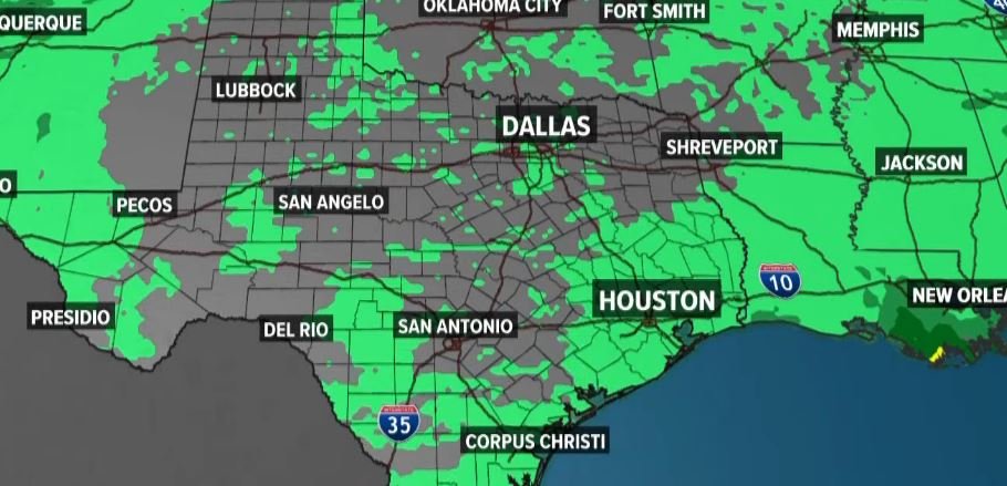
Therefore, knowing the weather isn’t really what makes live radar useful. It involves observing its actions. Interactive maps that allow you to zoom into particular neighborhoods rather than just “Houston” as a general blob on a map are provided by services like KPRC’s Click2Houston, ABC13’s regional radar network, and KHOU.
Galveston and Fort Bend County can be accessed independently. In almost real time, you can observe a storm cell moving northeast. That specificity is more important to residents of the outer suburbs than a general forecast for the entire city.
Galveston is served by the National Weather Service office that covers Houston, so you can see how broad the zone of concern really is. That radar footprint becomes crucial when tropical systems enter the picture. This week, Tropical Storm Bertha is traveling along the northern Gulf Coast and has already sent outer rain bands toward southeast Texas. Although Houston isn’t expected to be directly hit by Bertha, the outer edges of the storm could cause flash flooding in low-lying areas and heavy rain. In a city that still bears Harvey’s memory, that is not a minor issue.
It’s possible that most people simply watch the colors change and make decisions without giving radar technology much thought. However, Doppler radar measures precipitation’s intensity and movement in addition to its presence, which is something worth comprehending. There is a big difference in what is actually falling from the sky between a light green patch and a deep red core on your screen. Houston’s topography necessitates layered coverage, which is why local stations maintain networks of radar stations.
This summer, extreme heat has also gained attention. In addition to tropical advisories, forecasters are issuing Extreme Heat Warnings as heat index values in some areas of southeast Texas reach 116 degrees. That’s a lot to monitor at once, and it serves as a reminder that Houston’s weather problems are not seasonal. They are practically year-round.
Living in Houston seems to necessitate a particular attitude toward uncertainty. The weather never fully completes its decision. It’s not paranoia to keep your phone’s radar open; rather, it’s a sensible adaptation of a city that has sometimes learned the hard way that the sky deserves your attention.
