

A survey team from Shell Oil was searching the Gulf of Mexico’s seafloor in 2011 for potential drilling locations. The image that their sonar produced didn’t resemble geology. It was almost three-quarters of a mile underwater, measuring around 84 feet long by 26 feet wide, a configuration that no natural creation could have. Shell had a legal obligation to inform federal authorities. Investigators would later determine that what they had discovered was a copper-clad early nineteenth-century sailing ship that most likely sank in the same storm as two other ships discovered within five miles of it.
The Monterrey Shipwreck, as it became known, was the deepest deliberately excavated wreck in U.S. seas. It was called after Shell’s projected development site rather than any verified historical record. That’s a big difference. The site had been preserved in ways that shallower wrecks hardly ever accomplish due to the cold, low-oxygen conditions at that depth.
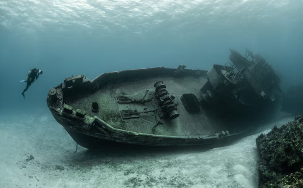
When researchers on board the E/V Nautilus sent down remotely operated vehicles in 2013, the cameras discovered leather-bound books, a navigator’s working slate, glass liquor bottles of various colors and shapes sitting upright on the seafloor, ceramic plates still stacked in their holds, eyeglasses, and medication bottles. personal belongings that had never been gathered. The copper sheathing, which was utilized at the time to shield hulls from marine worms, was still visible on the seabed like a chalk sketch of the ship’s ghost even if the timber planks had mostly decayed.
Investigators learned something subtly important from the artifacts: nobody survived on this ship. There were still navigational devices on board. telescopes. If a crew had had time to deboard in a planned manner, they would have taken these tools first. Whatever transpired happened quickly, and deep water took care of the rest, enclosing the scene in a chill that hardly varies over ages.
In the best way possible, the companion wrecks added complexity to the narrative. One had a steering wheel, a ship’s bell, and two anchors. Another seemed to be transporting supplies, perhaps for the Monterrey ship itself. The Gulf was a very hazardous passage route in the early 1800s, spreading quickly to international trade following the colonial era with traffic that lacked trustworthy maps for what lay underneath. Three ships went down in the same storm, in deep water, 170 miles from land.
It’s simple to ignore how unintentional the finding was and what it means for everything else out there. Approximately 2,000 hurricanes and tropical storms have been documented in the Gulf of Mexico alone throughout history. Prior to satellite navigation and contemporary weather forecasting, the Gulf of Mexico was used for commercial and military travel for centuries. The Mica Shipwreck, which was discovered in 2001 in 2,500 feet of water off the mouth of the Mississippi River and most likely dates to around 1825, is one of several other deep wrecks that BOEM’s maritime heritage program has documented through oil and gas surveys. Because these discoveries must be reported, they accumulate covertly, but the ocean floor between them has never been thoroughly examined to see what might be there.
That math has a frightening quality. Sonar systems, ROVs, and imaging equipment are among the present and developing methods for locating these places at depth. The seafloor is not covered. For two centuries, the Monterrey Shipwreck remained undisturbed until a drilling survey occurred to cross it. It’s difficult not to wonder how many other sites, just as intact, are waiting for another survey that isn’t searching for them at all, languishing in the same black water.
