When you take a humid morning drive south from Cambridge, Maryland, you begin to notice things you had not previously noticed. A row of corn at a field’s edge, with shorter, paler stalks that appear nearly translucent in the sunlight. a roadside ditch that shouldn’t be filled with water. A tractor that is parked far enough away from the damp ground so that the farmer is obviously aware of something that a casual visitor is not. These subdued signals are common along the Eastern Shore, and they don’t make for striking images. In a sense, that is the entire issue.
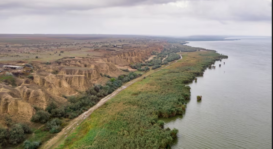
The focus is on ghost forests. Along tidal creeks, those skeletal stands of dead loblolly pines, tilted and bleached, have come to represent sea level rise on the East Coast. However, a recent study published in Nature Sustainability by researchers from VIMS and William & Mary’s Batten School indicates that the more somber tale is taking place nearby, in locations that don’t resemble graveyards. About 25,000 acres of farmland in the Delaware Bay and Chesapeake watersheds were lost to saltwater intrusion between 1984 and 2022. Marsh is spreading into cropland almost twice as quickly as it does into forests, and in certain areas, up to seven times more quickly.
The way Americans discuss climate adaptation is predicated on the idea that important land will be protected and that financial incentives will spur action. According to the study’s co-author and professor of marine science, Matt Kirwan, that notion isn’t holding up. He notes that for generations, farmers have constructed small levees and berms at the boundaries of fields. The saltwater was slowed by the structures. They never put an end to it. When his graduate student Grace Molino strolled through some of these locations, she discovered that while many berms were still in use, many others had been abandoned and were now partially engulfed by the marsh they were intended to keep out.
It is biology, not topography, that contributes to the vulnerability of farmland. Gradual exposure to salt may take decades for a mature oak to die. A soybean plant only has one growing season; if the groundwater becomes brackish in July, the row will be finished by August. Soybean plants do not have the luxury of decades. When you multiply that by thousands of acres, the loss increases in ways that satellite photos hardly notice until the damage is done. The ease with which this type of attrition blends into the background of a functioning farm is difficult to ignore.
Everything is complicated by the regulatory picture. Building new structural defenses became a permitting nightmare after Virginia and Maryland designated tidal wetlands as protected ecosystems in the 1970s, a truly significant environmental decision at the time. Therefore, the majority of the levees that are currently in place are aging, leaking, and retaining what they can. It is uncommon to find newer construction. Furthermore, despite the fact that less than 15% of America’s coastal watersheds are heavily developed, the federal discourse on coastal resilience still heavily favors seawalls and urban shorelines. The majority of the coastline is rural. The majority of it is not seriously protected.
It’s unclear what will happen next. With government assistance, some farmers are quietly accepting the loss by turning damaged fields into wildlife habitat or conservation easements. Others are continuing to maintain ditches and berms in the hopes that the math will get better. The topic of managed retreat has taken center stage in Louisiana, where a different Nature Sustainability paper suggests the coast may have already reached a point of no return. Many locals disagree with this term due to its implications regarding culture and home. The Mid-Atlantic does not yet exist. However, whether or not anyone is prepared for the conversation, it’s difficult to shake the feeling that it’s about to happen when you see a row of brown corn at the edge of an otherwise green field.