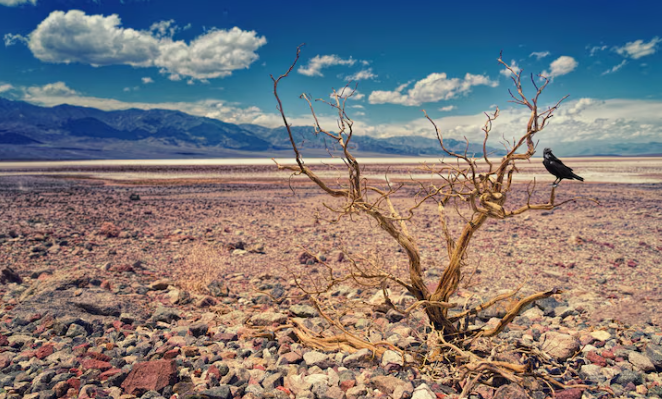
A wildflower bloom has a subtle, unnerving quality. This past March, at California’s Carrizo Plain National Monument, carpets of yellow and orange flowers covered the hills in a scene that seemed almost too lovely, like nature putting on its best face before a long, unsettling silence. California received that fleeting gift from a wet winter. However, the March 20th release of NOAA’s Spring Outlook makes it impossible to cling to that sentiment for very long. Forecasters predict that between April and June, drought conditions will get worse throughout much of the West and south-central Plains. The flowers were beautiful. The larger picture is much less so.
55% of the continental United States was already experiencing moderate to extreme drought conditions as of mid-March. Just that number merits a moment. Over half of the nation, including its farmland, rivers, and soil, is experiencing some level of dryness, and conditions are predicted to worsen as summer approaches. According to Jon Gottschalck, chief of the Operational Prediction Branch at NOAA’s Climate Prediction Center, wintertime conditions that were warmer and drier than usual made the drought considerably worse throughout the Great Plains, Lower Mississippi Valley, and portions of the Southeast. Usually a time for rejuvenation, winter failed to deliver.
It’s important to monitor the shift from La Niña to ENSO-neutral conditions this spring. It is a key component of the outlook for this season, according to Ken Graham, director of NOAA’s National Weather Service. While parts of the northern United States remain wetter and colder, La Niña tends to suppress precipitation throughout the southern tier of the country. Although it may seem relieving to move into neutral territory, forecasters are quick to temper that expectation. Low snowpack throughout the West results in less runoff feeding rivers and reservoirs through spring and early summer, further exacerbating the harm caused by the previous pattern. Overnight system resets are not possible.
The geography of the risk is what gives this specific outlook a heavier feel than a standard forecast. Due to years of recurrent dry cycles, the Pacific Northwest, the Great Basin, the central Rockies, and the Southwest are already under stress. In eastern Oregon and Colorado, ranchers have been observing the sky and soil with the kind of focus that only comes from real fear. Every new seasonal forecast in these landscapes seems to have significance beyond meteorology for communities connected to the water. It’s financial. It’s private. It touches on discussions that are currently taking place at kitchen tables on operational farms.
A significant area of the country is experiencing above-average temperatures, extending from the western United States eastward through the Mississippi Valley, the Plains, and the Southeast. An already challenging situation is made worse by heat layered on top of drought, which speeds up the loss of moisture from already depleted soils. The probability maps lean dry, especially from the Pacific Northwest down through the central Rockies, but it’s still unclear if any notable precipitation events could break the pattern before summer arrives.
The forecast contains some areas of relative optimism. The Southeast has a good chance of relief in its driest regions, and parts of the Midwest and Atlantic coast may see some improvement. However, the West, which has had to deal with diminishing water supplies for years, doesn’t seem to be taking a significant break this season. The cumulative weight of that is difficult to ignore: season after season, forecast after forecast, and each one finds the same obstinate dryness holding its ground.
As this happens, it becomes evident that these seasonal forecasts are more than just weather forecasts. They are, in a sense, snippets of a larger narrative about the nation’s relationship to water and the costs associated with rationing, negotiating, and fighting over it. NOAA will continue to update its models. For now, the ground remains dry.