

The ocean monitoring network does something that could be regarded as inconsistent each time a large cyclone passes across the Gulf of Mexico. The buoys that are meant to send temperature and wave data from directly beneath the storm become silent. Models rely on this data to forecast how quickly the storm will strengthen before reaching shore. Some people drag their anchors. Seas high enough to overcome their hulls overpower some. Some just cease to function when subjected to wave impacts that they were not intended to withstand. The instruments gathering the data are most likely to malfunction when the data is most important. The engineering approach to this gap, which has plagued hurricane forecasting for decades, has typically involved creating larger, heavier, more costly buoys that fail in somewhat different ways.
The design methodology that emerged from MIT research goes in the other way. The technology avoids the harshest circumstances by diving beneath them rather than constructing a surface buoy strong enough to withstand a Category 5 storm, which calls for materials and structural engineering that make the instrument expensive and challenging to deploy at scale.
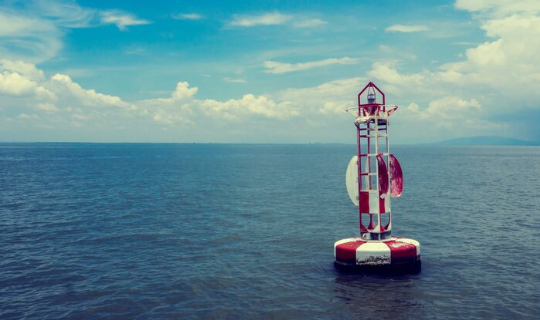
The winds that create 50-foot waves, the foam and spray that turn the upper meters of water into a churning mixture of saltwater and air, and the wave breaking that applies tremendous impulsive loads to anything sitting in that area are all focused at and close to the hurricane’s surface. None of that is taking place a few hundred meters below. The water is rather quiet, black, and frigid. Instead of being offline during the storm, a device that can wait out the storm and reach that depth collects data throughout.
The idea of profiling is not new in ocean instrumentation; for more than 20 years, Argo floats have provided temperature and salinity profiles throughout the world’s oceans using comparable dive-and-rise cycles. The application of this method to the particular issue of monitoring ocean heat content during active tropical storms, together with a design concept taken from the satellite industry’s creation of CubeSats, is what the MIT research adds.
Standard Argo floats are reliable and well-tested, but their data transmission times don’t always match what a storm-track forecasting model requires in real time, and they weren’t built or deployed with hurricane surveillance as their primary mission. The smaller, less expensive subsurface profilers created by this research are intended to be used in large quantities to give coverage density throughout the warm water regions where fast intensification episodes take place.
Beyond the simple engineering problem of storm survival, the application is significant from a scientific standpoint because of the data these instruments gather on ocean heat content. The energy derived from warm ocean water—more precisely, the temperature differential between the surface water and the water below, as well as the depth of the warm water layer—is what propels hurricane intensification. By churning up cooler water from below and cutting off its own fuel source, a storm can weaken as it moves across a shallow warm layer. When a storm comes into contact with a warm core eddy, which is a lens of abnormally warm water that extends hundreds of meters deep, it can quickly increase since no amount of churning exposes the cooler water beneath it. This interaction with underlying warm pools, which surface satellite data were unable to properly quantify, was a key factor in the intensification of Hurricane Katrina in 2005 and, more recently, in the rapid intensification cycles that have characterized several Gulf storms.
Data that was previously unavailable is provided by an instrument that sits beneath the active layer during a storm and constantly measures salinity and temperature profiles as the storm passes overhead. Aircraft dropsondes are used to measure the atmosphere above hurricanes. When they survive, surface buoys detect the conditions at the interface. During active events, the water column below—the 50 to 400 meter layer where the storm’s thermal fuel is stored—has traditionally been a black box. A significant improvement in the resources available to forecasting models is represented by instruments that can function in that layer during the event rather than recovering before to the storm.
Just as important as technological capability is the deployment model and cost. Conventional large moored buoys are expensive, cost hundreds of thousands of dollars apiece, need specialized research vessels for deployment, and are so numerous that there are significant coverage gaps throughout the western Atlantic and Gulf of Mexico. In order to provide the spatial coverage that storm track uncertainty demands, a smaller, less expensive profiling equipment that can be dropped from aircraft or deployed from small vessels can be used in far greater quantities. The economics of maintaining appropriate coverage are significantly altered if the instruments that malfunction or are lost during a large hurricane are significantly less expensive than their predecessors.
