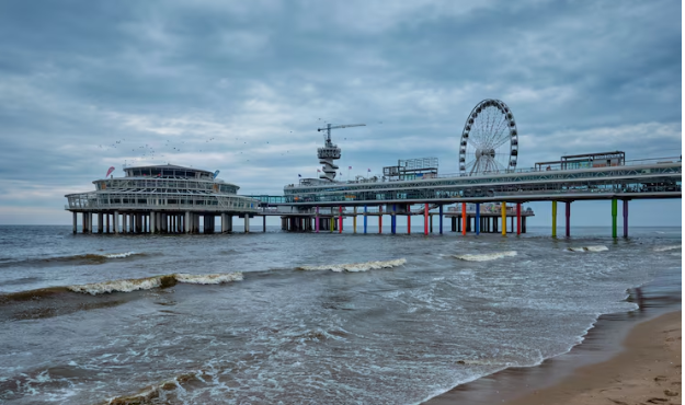
It feels completely normal to stand on Decatur Street in the French Quarter on a muggy afternoon, with the fragrance of the river blending with the cooking food from the open kitchen doors and the wooden balconies overhead providing shade for the banquette. Because this strip of land is a natural levee created over ages by the river depositing sediment during floods, the Mississippi is directly there, perhaps fifty yards away, higher than where you are. It is both the most high and the oldest area in New Orleans.
The earth beneath your feet is either at sea level or just above it. However, you’ve plummeted if you go fifteen minutes inland near Broadmoor. Not dramatically, not in a way that would make you feel uncomfortable. However, the topographic reality has changed. Now that you are between four and eight feet below the ocean’s surface, a system of designed walls and pumps that didn’t exist in its current form twenty years ago is keeping you safe from flooding.
Depending on the block, the answer to the question of whether New Orleans is below sea level is either yes or no. Certain parts of the city, including Lakeview, Gentilly, New Orleans East, and Broadmoor, are up to 12 feet below sea level. Approximately half of the city is below sea level. The city is situated in a bowl-shaped basin that is bounded to the north by Lake Pontchartrain, to the south by the Mississippi River, and to the south by the Gulf of Mexico.
The French Quarter, the Central Business District, and the riverside streets of Uptown were initially populated on the natural levees that run along the river, which are the highest terrain. The elevation decreases with increasing inland development, especially during the early and mid-20th century when drainage technologies made the marshy lowlands livable.
Both geological and human engineering factors contribute to the fact that a large portion of the city is currently below sea level. Originally situated on natural ridges and levees, New Orleans was constructed on land that was at or close to sea level. The organic soil underlying those reclaimed areas started to contract and shrink as the city expanded and its drainage systems sucked water out of the nearby marshlands to create space for communities. This process is known as subsidence.
The land just settled in the absence of the marsh’s continuous dampness. Parts of New Orleans are reportedly sinking at a rate of one to two inches annually due to decades of draining, creating a bowl that is still becoming deeper today. Rising sea levels compound the math in ways that most residents would rather not consider and that urban planners carefully consider.
Hurricane Katrina in 2005 illustrated the consequences of a malfunctioning protective system. About 80% of the city was flooded as a result of the levees breaking in several places, with the lowest-lying neighborhoods—Lakeview, the Lower Ninth Ward, and New Orleans East—suffering the worst. It was not a geographical coincidence that rooftops could be seen above standing water. They were the expected result of a breakdown in a system that is vital to the city’s life.
Since then, some $14.5 billion has been spent on improved floodwalls, levees, and surge barriers, including the enormous Lake Borgne Surge Barrier, which is currently among the biggest civil works projects in American history. Compared to before Katrina, the city is now better protected. It is neither completely or permanently shielded, according to anyone involved in the engineering.
Walking through a neighborhood like Gentilly on a clear day gives one the impression that the city’s relationship with water is more of a negotiation than a solution. The levees hold, and the pumping stations run continuously—New Orleans has more drainage pumps per square mile than any other city in the world. For the time being.
Even as the infrastructure gets better, the gap between the city and the surrounding water is getting less over geological time due to continuous subsidence and rising sea levels. For three centuries, New Orleans has managed to make that arrangement work. How many more centuries the current terms are valid is still unknown.