On the Aleutian Peninsula of Alaska, there is a time in mid-May when the strain of an entire fishing season becomes nearly intolerable. There will be salmon runs soon. The fleets are prepared. And until very recently, the passage that saves ships 160 nautical miles and 20 hours of arduous sailing was essentially lost somewhere in the narrow, tide-churned waters of Bechevin Bay.
Gone is not hyperbole. 28 of the 29 buoys that marked the channel through Bechevin Bay were gone by the time the U.S. Coast Guard evaluated the damage this spring; they had been completely destroyed by the type of winter that the Bering Sea brings every few decades and appears to be delivering more frequently these days. In late March, the ice extent reached almost record levels, filling the bay completely and extending as far south as False Pass. When it eventually retreated, it left behind a narrow, winding waterway devoid of almost all navigational markers, with sunken buoys hiding on the bottom as new dangers. If a commercial fishing vessel makes a mistake in that area, it may end up in less than 14 feet of water. That isn’t a risk metaphor. That could be a life, a loss, and a grounding.
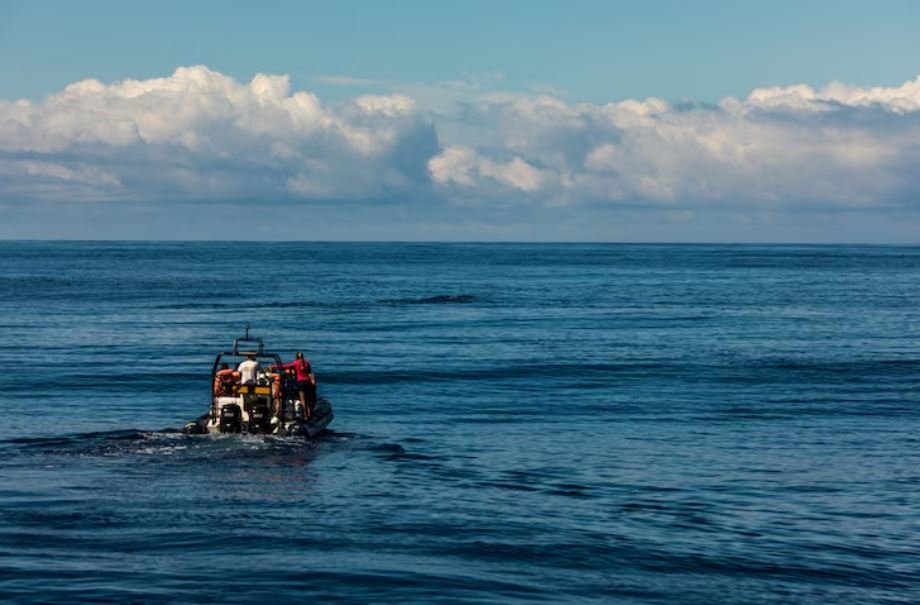
It’s difficult to overlook how silently this type of infrastructure functions until it disappears. The easternmost link between the Bering Sea and the Gulf of Alaska is Bechevin Bay, which is located just east of Unimak Island. The Bristol Bay sockeye run, which opened on June 1, is more than just a shortcut for the fleets and communities using it. Instead of slogging through the offshore run, this route keeps ships in calmer, more protected waters. For generations, fishermen have been navigating this passage, counting buoys, reading the channel’s tight turns, and timing their transits around the tidal currents. The certainty that enabled any of that vanished along with those buoys.
Depending on your point of view, what transpired next was either a simple interagency operation or a subtly impressive example of coordination under duress. The Fairweather, a hydrographic survey ship already assigned to planned missions, was rerouted by NOAA’s Office of Coast Survey to assist the Coast Guard cutter Cypress in reopening the channel. Finding a navigable route, looking for sunken buoys, spotting submerged hazards, and providing high-resolution bathymetric imaging in almost real-time were all tasks assigned to the Fairweather’s hydrographic survey crews. The Cypress crew set 14 new buoys within hours of receiving that information. The passage was operational prior to the June 1 opener, but the northern half of the channel still requires work and is anticipated to be finished over the next few weeks.
It doesn’t happen by accident that fast. Reopening ports and waterways after disasters is the ship’s primary mission, and this winter qualified, so it appears that the Fairweather crew knows how to operate in precisely this kind of situation. However, it’s remarkable how much had to go at once. In order for a Cypress crew to execute buoy placement in a waterway characterized by strong currents and shallow margins, the survey data had to be received quickly, accurate enough to be trusted for immediate buoy placement, and readable. It was successful. Even though the agencies won’t say so, it’s important to note.
It is easy to underestimate the stakes involved in this operation. For Alaska as well as the larger seafood supply chain, Bristol Bay’s sockeye salmon season is one of the world’s most important commercial fisheries. Fishing fleets had been getting ready for a robust 2026 return, as predicted by the Alaska Department of Fish and Game. The Bechevin Bay route is not a luxury for ships passing through Kodiak. It’s the sensible option, preventing boats from entering heavier waters and saving a significant amount of time and fuel. Longer transits, increased exposure, and increased expenses would have resulted from losing that passage just before the opener. These pressures swiftly spread to fishing operations that already operate on thin margins.
Whether incidents like the ice damage this winter will become more frequent is still up in the air. In recent years, the Bering Sea has exhibited erratic behavior, alternating between ice-heavy and low-ice winters in patterns that defy easy explanation. It seems reasonable to assume that as conditions become less predictable, the infrastructure that supports these fisheries—the buoys, charts, survey ships, and cutters—will become more important rather than less. Throughout the summer, the Fairweather is expected to continue operating in Arctic waters and around St. Matthew Island. There’s a lot of water to cover.
The channel is open as of right now. At least in the southern half, the buoys are in position. Fishing boats that used to know this route by heart are learning it again somewhere off the Aleutians. They are threading a waterway that was nearly unavailable to them this season, counting new markers, and running the tides. That is both a source of relief and a source of vulnerability. The ice doesn’t bargain.