Mining something you cannot see, touch, or even reach without a vehicle that costs millions of dollars to operate requires a certain kind of ambition. But that’s precisely what an increasing number of resource companies are trying to do: they’re sending technology into the ocean floor’s darkness in the hopes that what’s there could change how the world gets its essential minerals. The operation doesn’t resemble a traditional mine at all. No dust clouds, no boots on rock, no open pits. Instead, a ship is positioned somewhere over the Clarion-Clipperton Zone, scanning a seafloor four kilometers below with sonar.
Geographic Information Systems and Artificial Intelligence, two technologies that have been quietly developing for years, are coming together to make this possible, or at least conceivable. For decades, mining companies on land have used GIS to track geology, manage risk, and comprehend their terrain. It became as essential to exploration as a compass used to be. These same capabilities are now being taken offshore, modified, and sometimes entirely reimagined for a setting with completely different regulations.
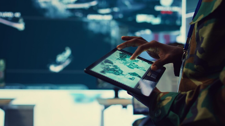
Mining in the deep ocean is more complex than mining on land. It’s a different kind of issue. Every insight must come from sensors in the absence of light, direct sampling access, or the ability to simply walk a ridge and read an outcrop. The image is created by multibeam sonar. Texture is filled in by acoustic backscatter. ROV cameras move along transects, recording video that needs to be interpreted by someone. Manual analysis was never going to be viable due to the sheer amount of data that was returned.
At that point, the AI component begins to make sense. In order to automatically classify seafloor substrates, identify biological communities that may complicate environmental assessments, and flag geomorphological features that may indicate mineralization, machine learning models are being trained. Although it’s still unclear if these models consistently perform at the scale and diversity of real deep-sea campaigns, preliminary findings indicate that the direction is correct. Teams are starting to significantly shorten the time it used to take to interpret sonar datasets.
The fact that the world’s most remote environment is currently producing more data than field teams can reasonably process is something worth pondering. By absorbing vessel positioning, environmental sensor feeds, survey tracks, sample geochemistry, and synthesizing it into something a geoscientist can actually use to make a decision, platforms such as ArcGIS are acting less like mapping tools and more like the central nervous system of an entire exploration program.
An additional level of complexity is introduced by the environmental dimension. There are significant ecological risks associated with deep-sea mineral extraction, and both commercial interest and regulatory scrutiny are increasing. For operators who must demonstrate responsible practice rather than merely assert it, GIS environments that can track benthic habitats, model sediment plume behavior, and record baseline biodiversity observations are becoming indispensable. In ways that would have seemed premature ten years ago, the foundational ocean datasets that organizations like NOAA and BOEM have been developing for years are now flowing into exploration frameworks.
The gradual realization that the data problem and the extraction problem are inseparable is a pattern that is difficult to ignore and is similar to what has occurred in terrestrial mining over the past 20 years. Businesses that became proficient in land-based spatial intelligence developed long-term competitive advantages. The same dynamic appears to be emerging offshore, but it’s more condensed, technically challenging, and has greater stakes for doing the environmental math correctly.
It is still genuinely unclear if deep-sea mining will eventually fulfill its promise of a mineral supply. The deposits are genuine. Technology is developing. What is economically and politically feasible still differs greatly from what is technically feasible. However, the AI models, real-time operational platforms, and sonar-driven spatial frameworks that are being developed to bridge that gap are gaining capability more quickly than most observers anticipated.