Close Menu
Indeep ProjectIndeep Project
  • Home
  • Privacy Policy
  • Terms of Service
  • Disclaimer
  • About
  • Indeep
  • Marine Life
  • News
Indeep ProjectIndeep Project
SUBSCRIBE
  • Home
  • Privacy Policy
  • Terms of Service
  • Disclaimer
  • About
  • Indeep
  • Marine Life
  • News
Indeep ProjectIndeep Project
Home»Climate Change»China Just Published Maps Detailing Billions in Minerals on the Ocean Floor
Climate Change

China Just Published Maps Detailing Billions in Minerals on the Ocean Floor

Derrick LesterBy Derrick LesterMay 5, 2026No Comments4 Mins Read
Share
Facebook Twitter Reddit Telegram Pinterest Email

Beijing has become rather adept at a certain type of announcement, the kind that arrives on a Tuesday, is cloaked in technical jargon, and only then discloses its true meaning. That pattern is almost perfectly matched by the publication of China’s “seabed chemical element map” of its eastern waters.

It appears to be standard scientific housekeeping at first glance. Surveys for twenty years. Twenty thousand places for sampling. A final compilation of a geochemical atlas. However, if you sit with it for a while, the image becomes clearer.

Key InformationDetails
Announcing BodyChina’s Ministry of Natural Resources
Reported ByCCTV News, Global Times
Region CoveredBohai Sea, Yellow Sea, East China Sea
Survey DurationNearly 20 years of geological work
Sampling SitesMore than 20,000 locations
Lead Research BodyQingdao Institute of Marine Geology
Key Researcher QuotedDou Yanguang, China Geological Survey
Elements MappedIron, manganese, copper, rare earth elements, and dozens more
MethodologySurface sediment data fused with machine-learning analysis
Stated PurposesCoastal planning, ecological protection, mineral exploration
Strategic Plan Linkage15th Five-Year Plan (2026–30), marine resource development
Related AssetsFendouzhe submersible, Mengxiang drilling vessel, seabed sensor networks

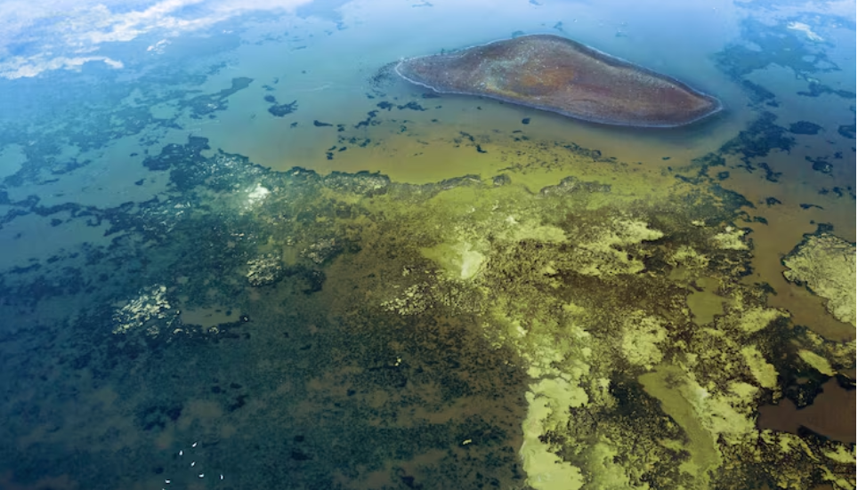
The Bohai Sea, the Yellow Sea, and the East China Sea are all included on the map. These bodies of water connect the Eurasian mainland to the Pacific and coincide with some of the world’s most disputed maritime territory. The collection is referred to by officials as a “navigation chart” for marine development. That wording is cautious. Iron, copper, manganese, and rare earths are among the minerals it alludes to without quite stating “fortune,” but given how deeply ingrained rare earths are in the current global economy, it is difficult to ignore the connotation.

Walking through the details, the patience of it is what sticks out. After 20 years of ships collecting samples, scientists recording data, and machine-learning models finally piecing everything together. Most governments typically underfund or give up on this kind of tedious, unglamorous effort halfway through.

China Just Published Maps

Beijing didn’t. Furthermore, the release’s timing—which coincides with the new Five-Year Plan’s request for “a new round of comprehensive marine surveys”—feels more like choreography than chance.

Beneath the official conversation, a more subdued one is taking place. Dozens of Chinese research vessels have been cruising the Pacific, Indian, and Arctic oceans, mapping seabeds in patterns that naval analysts claim resemble submarine warfare training, according to a Reuters investigation earlier this year. The Dong Fang Hong 3, whose name translates almost poetically to “The East is Red,” traveled through waters close to Taiwan, Guam, and the approaches to the Malacca Strait for two years. It was officially a study of climate and mud. Experts who have seen the tracking data informally characterize something more akin to battlespace readiness. Beijing now publicly refers to this crossover between military utility and civilian science as “civil-military fusion.”

Although it isn’t stated in the press release, this new eastern-waters map fits into that larger narrative. The location of copper can be found using a geochemical atlas. Additionally, it provides information about the composition of the bottom, which is crucial if you’re attempting to locate or conceal a submarine. The researcher cited in official media, Dou Yanguang, presented the findings in clear, scientific terms: pollution detection, ecological red lines, and more intelligent mineral targeting. Probably all of that is true. Moreover, it is lacking.

It’s difficult to ignore how the discourse surrounding marine resources has changed over the last several years. The term “security” is increasingly being used to characterize what was once described as exploration. chains of supply. sovereignty. depth of strategy. The Global Times cited Wu Chenhui, an analyst who described the map as a basis for “long-term supply security”—a concept that does a lot of work. From a distance, Western capitals will see it differently than Beijing does.

It’s yet unknown if the rest of the globe replies with its own atlases, surveys, and gradual information building. The seafloor, which has long been regarded as backdrop, appears to be moving in the direction of the map’s center.

China Maps
Share. Facebook Twitter Pinterest LinkedIn Telegram Reddit Email
Previous ArticleChina’s All-Weather Deep-Sea Megastructure Has the West on High Alert
Next Article The Unseen Threat of Underwater Noise Pollution Discovered by Oceanographers
Derrick Lester

    Derrick Lester is a professor and editor at indeep-project.org. His academic career has been molded by a single, enduring obsession: the sea and all life in it. Drawing from marine biology, oceanography, and the kind of hard-won field knowledge that only comes from spending significant time on and under the water, Derrick's writing has the depth of a scholar thanks to his years of research and teaching experience. His writing delves into the science of marine life with the inquisitiveness of someone who has never fully moved past the wonder of what exists beneath the surface. Derrick hopes to introduce readers to a world that encompasses over 70% of the planet and is, in many respects, still largely unexplored through his contributions to indeep-project.org.

    Related Posts

    How Climate Mitigation Scenarios Might Actually Hurt Emergent Deep-Ocean Patterns

    May 5, 2026

    China’s New AI Ocean Tool: Scientific Breakthrough or Covert Surveillance Mastermind?

    May 5, 2026

    Inside China’s 30-Story Floating Island: The Dawn of a New Deep-Sea Arms Race

    May 5, 2026

    How Climate Change Is Threatening the Economic Backbone of the Entire Pacific

    May 5, 2026

    Scientists Dropped a Camera 9,100 Meters Into the Ocean Off Japan. The Footage Left Them Speechless.

    April 28, 2026

    When the Ocean Boils: The Shocking Reality of Florida’s 100-Degree Coastal Waters

    April 28, 2026
    Add A Comment
    Leave A Reply Cancel Reply

    You must be logged in to post a comment.

    Don't Miss

    The Golden Orb Mystery That Stumped Deep-Sea Researchers for Years Has Finally Been Solved

    By Derrick LesterMay 5, 2026

    When something unexpected shows up on the screen, a certain type of stillness descends upon…

    Scientists Are Discovering That Deep-Sea Ecosystems Are Far More Interconnected Than Any Model Predicted

    May 5, 2026

    How Climate Mitigation Scenarios Might Actually Hurt Emergent Deep-Ocean Patterns

    May 5, 2026

    The North Atlantic’s Ventilation Change: How Three Decades of Warming Altered the Seas

    May 5, 2026

    China’s New AI Ocean Tool: Scientific Breakthrough or Covert Surveillance Mastermind?

    May 5, 2026

    Inside China’s 30-Story Floating Island: The Dawn of a New Deep-Sea Arms Race

    May 5, 2026

    The University of Delaware Student Who Dove Deeper Than Most Humans Have Ever Gone — and What She Found

    May 5, 2026
    About Us
    About Us

    Indeep-project.org is dedicated to disseminating information that is supported by data, open about its sources, and truthful about the limits of human knowledge.
    Peer-reviewed studies, official scientific publications, and the knowledge of contributors with firsthand knowledge of ecology, environmental policy, and marine science are all sources of information used by our editorial team. Content that expresses opinion is clearly marked as such, whether it comes from our own contributors or from outside sources.
    Important Information Opinion pieces, commentary, and third-party viewpoints on subjects like science, technology, finance, politics, and public policy are among the content published on indeep-project.org. Only educational and informational purposes are served by this content. It does not constitute expert scientific, financial, legal, or medical advice; rather, it reflects the opinions of the original authors.
    We strongly advise readers to seek qualified professional advice appropriate to their particular circumstances before acting on political, financial, or scientific information published on this platform. Decisions based on third-party opinion content published here are not endorsed, recommended, or liable for by indeep-project.org.

    Our Picks

    The North Atlantic’s Ventilation Change: How Three Decades of Warming Altered the Seas

    May 5, 2026

    China’s New AI Ocean Tool: Scientific Breakthrough or Covert Surveillance Mastermind?

    May 5, 2026

    Inside China’s 30-Story Floating Island: The Dawn of a New Deep-Sea Arms Race

    May 5, 2026

    The University of Delaware Student Who Dove Deeper Than Most Humans Have Ever Gone — and What She Found

    May 5, 2026

    UK and Portugal Are Quietly Building the Most Ambitious Deep-Sea Research Partnership in the North Atlantic

    May 5, 2026

    Inside the Mission to Chart Atlantic Deep-Sea Life Before Deep-Sea Mining Destroys It

    May 5, 2026
    • Home
    • Privacy Policy
    • Terms of Service
    • Disclaimer
    • About
    • Indeep
    • Marine Life
    • News
    © 2026 ThemeSphere. Designed by ThemeSphere.

    Type above and press Enter to search. Press Esc to cancel.