It’s really hard to put into words what it’s like for a researcher to watch a 3D laser scan of a gelatinous deep-sea creature rotate slowly on a screen for the first time—something that has never been seen by human eyes before. Not precisely excitement. More akin to vertigo. Although the ocean has always been enormous, we’re starting to realize how much we’ve been missing recently due to the convergence of satellite technology and precise mapping tools.
Our maps of the ocean floor were embarrassingly crude for decades. With some discomfort, scientists have noted that we have charted Mars’ surface more precisely than our own seabed. That is gradually shifting. Researchers can now determine the shape of the seafloor without ever physically visiting it thanks to satellite altimetry, which measures minute changes in sea surface height brought on by the gravitational pull of underwater mountains, ridges, and trenches below. When combined with remotely controlled vehicles and ship-based sonar systems, these technologies are creating something truly novel: a three-dimensional depiction of the deep.
The science of measuring ocean depth, or bathymetric mapping, dates back to the middle of the 20th century. However, the conclusion was clumsy, akin to attempting to read a book through frosted glass. Thirty years ago, it would have seemed impossible to capture every ridge, canyon, and volcanic seamount with the precision of modern multibeam sonar mounted on research vessels and increasingly on autonomous underwater drones. Over 25% of the ocean floor has already been mapped in high resolution as part of the global Seabed 2030 project, which aims to map the entire ocean floor by the end of this decade. That sounds humble. However, keep in mind that the percentage was closer to 6% prior to the project’s 2017 launch.
What the maps are showing is shocking. mountain ranges underwater that are longer than the Himalayas. Like geological scars, deep trenches cut across the Pacific. And in between, vast expanses of midwater, the column that lies between the seafloor and the sunlit surface, which might be the planet’s largest inhabited area. In just two weeks, a recent expedition aboard the Schmidt Ocean Institute’s research vessel off the coast of Brazil found 31 completely new species in this midwater zone, including nine jellyfish, seven siphonophores, and a gossamer worm that moves in unexpected ways given its body structure. There might be thousands more down there, unidentified, unnoticed, floating in the shadows.
It is worthwhile to investigate the technology that made these discoveries possible. Devices like DeepPIV and EyeRIS, created at the Monterey Bay Aquarium Research Institute, scan living animals using lasers instead of nets, creating 3D images without upsetting delicate gelatinous bodies. These animals were shredded using conventional sampling techniques. In contrast, the new strategy is practically tender. It seems as though scientists are finally being given access to a room that has always existed but was always locked when watching the footage from these dives.
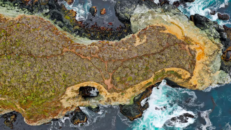
In a less obvious but no less significant way, satellite data contributes to this picture. The large-scale architecture of the seafloor, where tectonic plates have fractured, where magma once pushed upward, and where entire underwater plateaus rise silently in the dark, is revealed by gravity anomalies found from orbit. Although the precise amount of satellite resolution improvement is still unknown, current trends indicate that the maps will continue to get much sharper through the late 2020s.
All of this has an almost philosophical quality. Despite the fact that the ocean makes up 71% of the planet’s surface, controls its climate, and supports the majority of life on Earth, we have treated it as practically unknown for centuries. That was not inevitable, according to the maps that are currently being created. It was simply challenging. It turns out that technology is quietly resolving this challenging issue, one satellite pass and one sonar ping at a time.